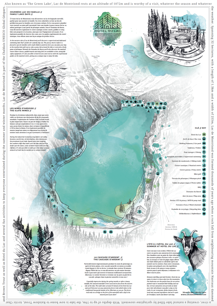
Making the Lac de Montriond Map
Lac de Montriond is one of the most popular destinations in our valley during the summer months. Can there be a better way to spend an afternoon than hiking up through the forest, catching glimpses of the pristine, turquoise waters through the trees as you go? When you arrive on the shore of the lake, it’s impossible not to take a dip; the water is always so enticing and so refreshing.
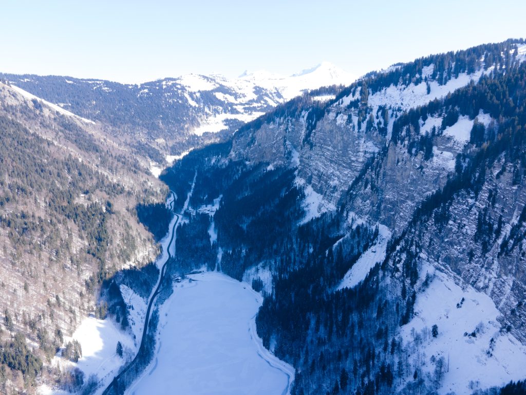
Spanning 32 hectares, with a length of 1.3km and a width of 253m, Lac de Montriond was formed thousands of years ago when a rock fall from neighbouring mountain Nantaux dammed a river, creating a natural lake filled by springtime snowmelt. With depths of up to 19m, the lake is now home to Rainbow Trout, Arctic Char and Brown Trout as well as several fun activities to keep everyone entertained during the summer months.
Of course with all of these new activities, which include stand-up paddle boarding, canoeing, mini golf and pony trekking, come many more visitors. To make sure that everyone makes the most of their time at the lake, we’ve created a stunning, hand-drawn map, which we’ll for the first time this summer. We’ve worked with acclaimed artist RP Roberts and the Morzine Source Magazine design team to feature a summer lake on one side and a winter lake on the other. The maps are available free of charge from the team inside Hotel du Lac and we hope you love them as much as we do.
The Drone
We enlisted the help of local adventure photographer and videographer Lee Higgins of @lpmediahouse to fly a drone over the lake in February 23. The purpose was to provide the artist with as much perspective on the shoreline and the surrounding cliff faces as possible to begin the project. Lac de Montriond has a unique shape with stunning views from each side and it was important to capture as many details as possible.
The Artist
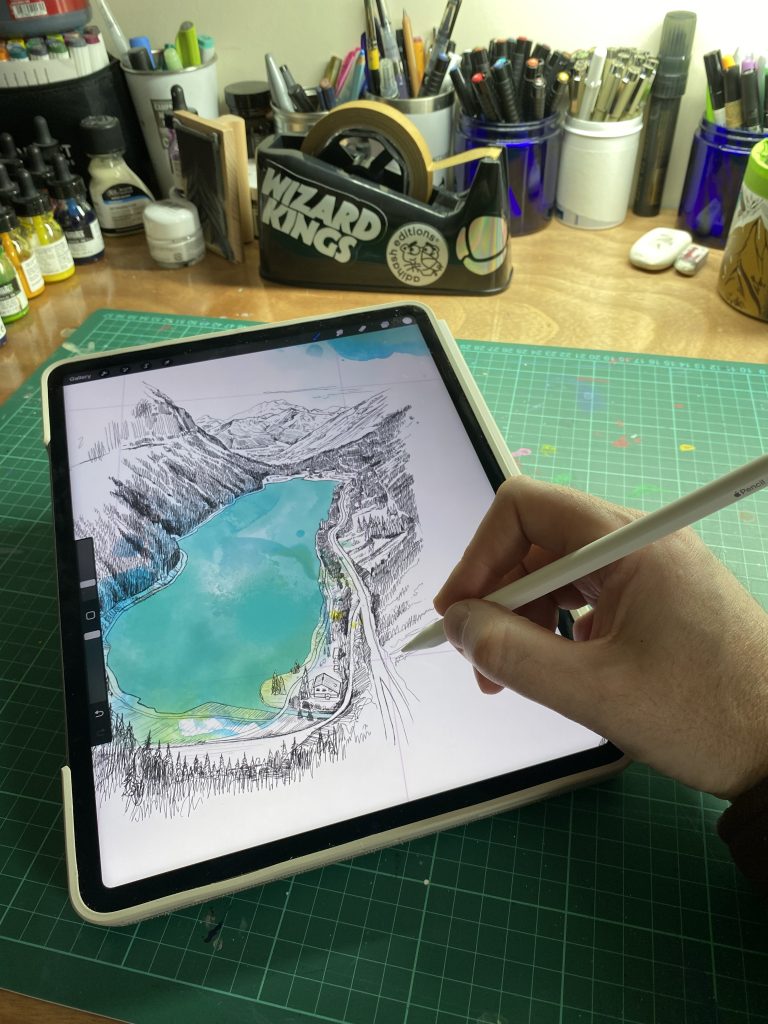
Several briefings and discussions later, RP Roberts began work, illustrating the shoreline of the lake in his unique, hand-drawn style. He’s worked on snowboard graphics for Jones Snowboards, he’s designed clothing for Etnies and he undertakes several large-scale landscape commissions, but this is the first time he’s ever worked on a map project. The project quickly expanded and we began to incorporate other interesting elements from around the lake, such as the Cascade d’Ardent, the slate mines and the fascinating, ancient church in Montriond village.
The Words
With a lot of information to feature on the map, but a huge will to keep RP Robert’s graphics as clear as possible, we set about adding text, detail and locations to the map, including directions to those extra special walking routes that surround the lake, ideas for fun family lake days, the various restaurants, picnic tables and of course the toilets. Hotel du Lac sits just minutes from the telecabine d’Ardent, which, during the winter months, makes it quick and easy to access the pistes of the Portes du Soleil. Adding this detail to the winter version of the map proved to be a challenge!
The Design
Through a series of trial and error, the design team at Morzine Source Magazine nudged the images created by RP Roberts, shuffled the text and added a key to denote the various activities available at the lake to ensure there was enough space for all elements. The finished result is a beautiful, collectable map featuring Lac de Montriond during the summer months on one side, and the winter months on the other.
The Map
Collect your free copy of the Lac de Montriond map, complete with all the information you need to plan your ultimate day on the shores of a stunning alpine lake, from the hotel’s reception area.